
Flag Rock
AREA TRAILS

Get Outside
In Norton
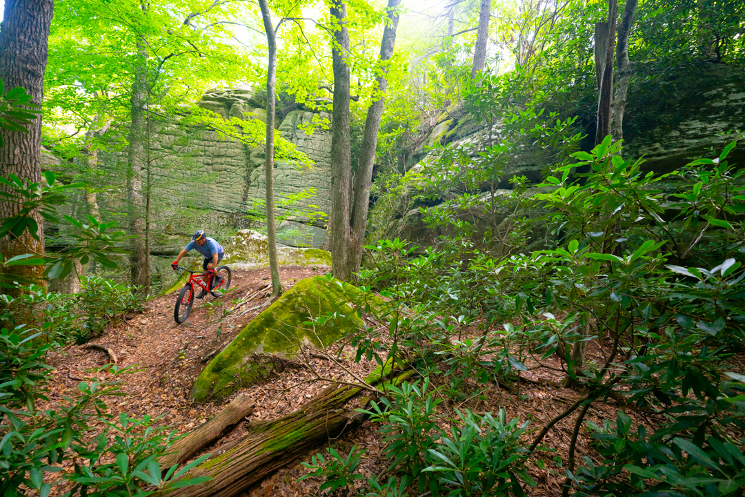
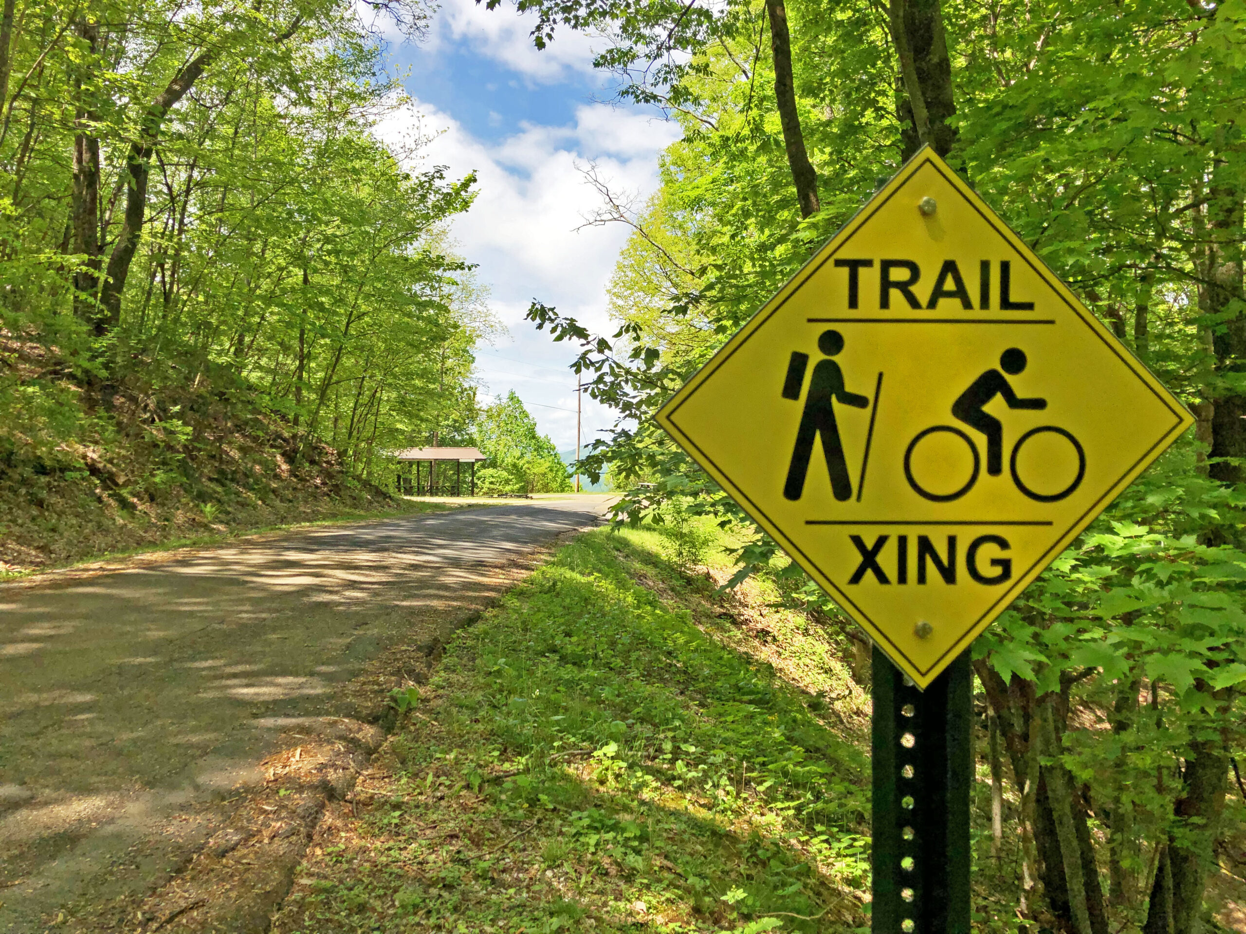
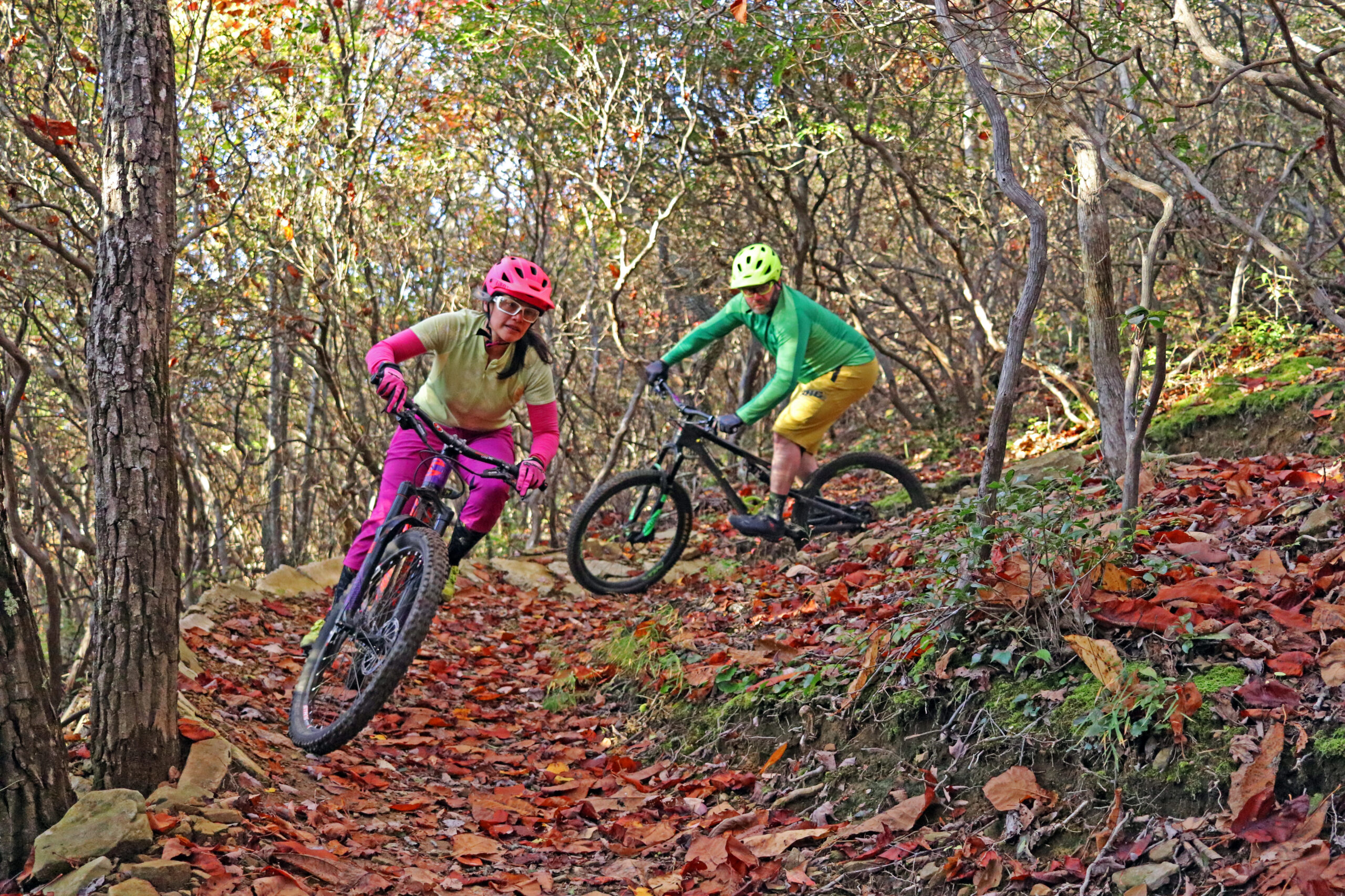
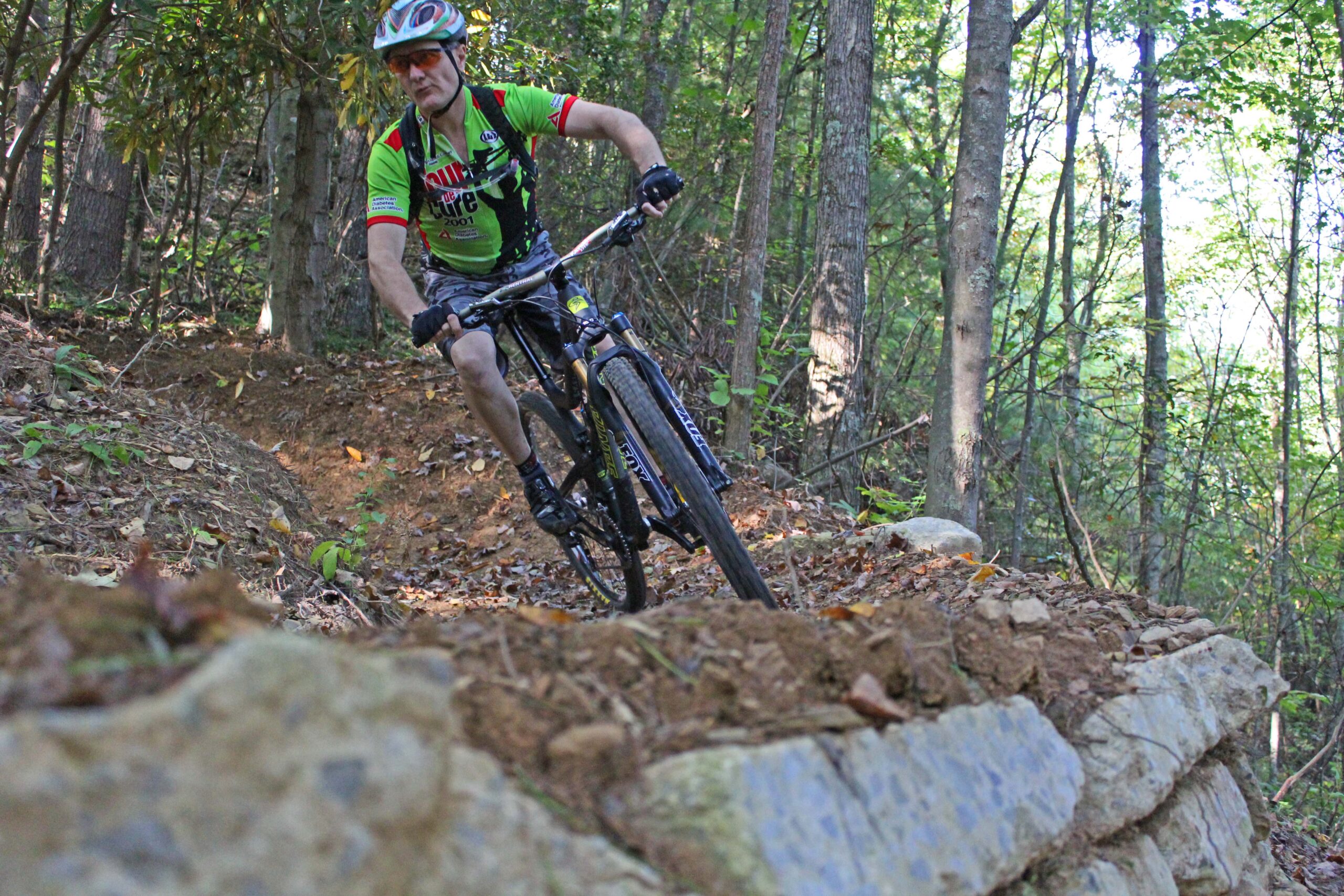
The City of Norton’s Flag Rock Area Trails offer 10-plus miles of mountain bike trails that are also open to foot travel, including hiking and trail running. Trails travel through rhododendron thickets, past giant sandstone boulders and cliffs, and through beautiful hardwood forests as they wind through Flag Rock Recreation Area.
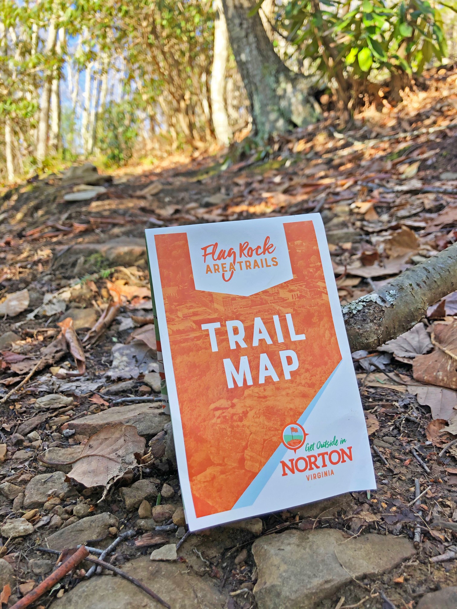
Flag Rock Area Trails
The Flag Rock Area Trails system is being built in Norton’s thousand-acre Flag Rock Recreation Area. The first trail opened in 2014. The system now spans more than 10 miles, with difficulty ratings stretching from novice to expert. Click below to download a copy of the trail map and scroll down for individual trail descriptions.
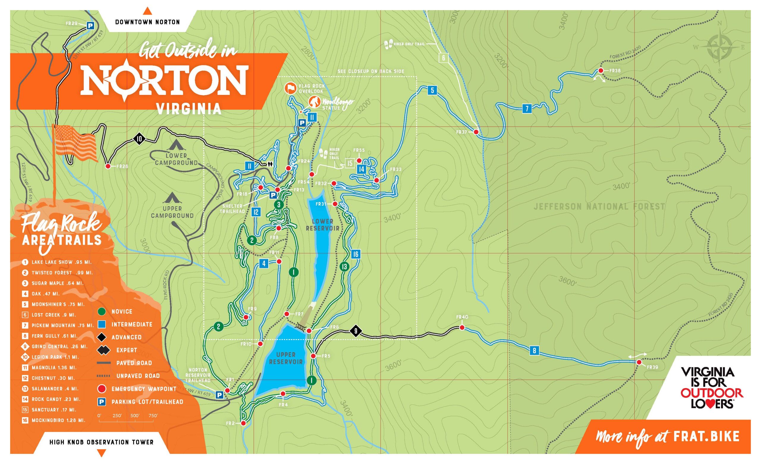
Norton Reservoir Trailhead
Shelter Trailhead
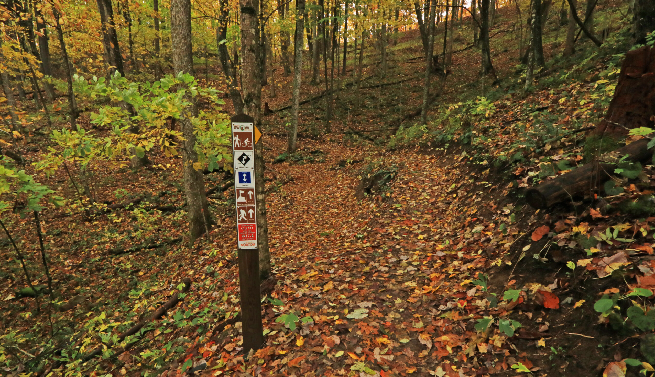
Getting Here
There are currently two main trailheads for Flag Rock Area Trails.
The Shelter Trailhead near Flag Rock Overlook offers direct access to two trails: Sugar Maple and Magnolia.
The Norton Reservoir Trailhead offers direct access to three trails: Lake Lake Show, Twisted Forest, and Reservoir Road.
Trail Info
NOVICE TRAILS
Gentle climbs and descents with obstacles such as rocks, gravel, roots, bridges, humps, holes, and berms. General bike handling skills are suggested before using these trails.
Sugar Maple (0.64 miles)
The Sugar Maple Trail begins at the Shelter Trailhead (near the two large group picnic shelters) and serves as a primary access trail from the park proper to the core loop of the system.
Lake Lake Show (0.95 miles)
Lake Lake Show Trail begins at the Norton Reservoir Trailhead and forms the eastern side of the core loop of the trail system. This trail affords views of the Upper and Lower reservoirs and connects to Twisted Forest to complete the core loop.
Twisted Forest (0.99 miles)
Twisted Forest Trail begins at the Reservoir Trailhead and forms the western side of the core loop. It travels through a large tangle of mountain laurel before opening into a mature hardwood forest. Twisted Forest connects to Lake Lake Show to complete the core loop.
Salamander (0.4 miles)
Salamander Trail can be accessed from Lake Lake Show Trail. Salamander offers winter views of the Lower Reservoir and directly connects to Mockingbird and Moonshiner’s trails.
INTERMEDIATE TRAILS
Challenging riding, with steeper climbs and descents and obstacles. Trail may be narrow with poor traction. Shorter sight-lines common.
Fern Gully (0.61 miles)
Fern Gully is part of a connector between the Upper Norton Reservoir and Forest Road 2420 on adjacent Jefferson National Forest property. Fern Gully begins at Forest Road 2420 and heads back onto city property, connecting with Grind Central, before descending to Lake Lake Show and the Upper Reservoir.
Forest Road 2420 (2.7 miles)
This gated forest road connects to Forest Road 238C, which climbs to the main ridge road on High Knob (Forest Road 238) to the south. A segment of Forest Road 2420 (approximately 1.7 miles) connects the east end of Pickem Mountain Trail and the east end of Fern Gully, forming a loop totaling approximately 4.2 miles.
Magnolia (1.36 miles)
Begins at the Shelter Trailhead (near the two large group picnic shelters). Note: Trail is still under construction.
Moonshiner’s (0.75 miles)
Moonshiner’s begins at the northern end of Reservoir Road and continues down to the junction with Lost Creek and Pickem Mountain.
Oak (0.47 miles)
Oak consists of a 0.24-mile single-track segment from Twisted Forest to Reservoir Trail and shares the 0.23-mile southern end of Reservoir Trail to where it connects with Reservoir Road. Note: The northern segment of Reservoir Trail (0.22 miles) is HIKER ONLY.
Pickem Mountain (0.75 miles)
Pickem Mountain connects Moonshiner’s to Forest Road 2420. This trail lies mostly on National Forest property. If coming from Moonshiner’s, this trail climbs steadily for most of its length.
Chestnut (0.3 miles)
Chestnut connects Magnolia Trail to the junction where Lake Lake Show, Sugar Maple, and Twisted Forest trails meet. The trail offers a steady climb from Magnolia or a steady decline if accessing from its connection to Lake Lake Show, Sugar Maple, and Twisted Forest.
Rock Candy (0.23 miles)
Rock Candy weaves through several giant sandstone boulders and can be accessed from Mockingbird Trail. The trail also travels near a rock climbing area being developed in Flag Rock Recreation Area.
Mockingbird (1.28 miles)
Mockingbird can be accessed directly from Lake Lake Show or Grind Central trails. The trail offers winter views of the Lower Reservoir and connects to Salamander and Moonshiner’s.
ADVANCED TRAILS
These trails may be narrower, have long steep descents and climbs, loose trail surfaces, and numerous natural and man-made obstacles.
Grind Central (0.26 miles)
Grind Central connects Fern Gully to Lake Lake Show on the east side of the Upper Reservoir. It is a steep descent from Fern Gully, or a serious “grind” from Lake Lake Show (steep, but not too technical).
EXPERT TRAILS
These trails include extended steep descents, including rock drops and steep rock faces, very narrow trails, man-made ramps and other extreme features. Only recommended for highly skilled riders.
Legion Park (1.3 miles)
This trail begins just to the left of the restrooms located in the middle of Flag Rock Recreation Area. Legion Park Trail begins with a steep fall-line, followed by a descending ridge into a primitive campground. The trail continues down a double-track before turning sharply to the right, back onto single-track, and soon dropping down another steep fall-line. The rider empties out onto an old logging road (semi-double-track). Bear left, and then right, before crossing State Route 619 and finishing at Legion Park.

Volunteer Opportunities
We welcome individuals to assist with trail cleanups, work special events and programs, and build trails. Trail construction is an ongoing and lengthy project, so trail work volunteers are always welcome.
If spending the day outdoors alongside other trail enthusiasts and giving back to your community interests you, please take a moment and fill out our Volunteer Registration Form. For more information, email [email protected].


